


Nepal’s parliament has approved a new map of the country, including areas disputed with India.
The move by the Nepalese parliament threatens to escalate the decades-old border dispute with neighbouring India, signalling Nepal’s tough policy.
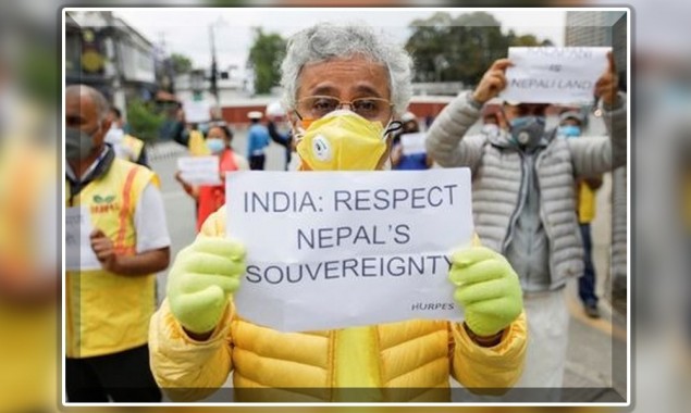
On the other hand, India rejected the new map of Nepal, calling it a one-sided move and saying it was not based on historical facts or evidence.
Nepal released a revised map last month after India inaugurated an 80-kilometre road connecting the northern state of Uttarakhand to Lipulekh on the Tibetan border.
Nepal claims that the area through which the road passes is not part of India but part of Nepal.
The map shows the strip of northwestern Nepal as Nepalese territory.
Agni Prasad Sepakota, the speaker of Nepal’s parliament, said the new map was approved by the more than two-thirds of the majority 258 members out of the 275 voted for the bill. He said there was no vote against the map.
The map approved by the lower house will also be approved by the National Assembly to become part of the constitution, after which President Budhya Devi Bhandari’s approval will be required.
Prachanda, head of the ruling Communist Party of Nepal and former prime minister, said Nepal did not want to complicate matters and wanted a peaceful solution.
“We want to resolve the issue through peaceful dialogue at the political and diplomatic level with India,” he said.
It is to be noted that India did not make any comment on the voting in the Parliament of Nepal for the new map.
Also read: Nepalese PM accuses India to spread Cronavirus in Nepal
The border dispute between India and Nepal
Tensions between India and Nepal have been simmering for at least 200 years over an area on the border between the two countries called Kala Pani.
Historically, the area was part of Nepal, but in 1816 an agreement was reached between the state of Nepal and the then British Indian Government of United India, which was called the Sagoli Treaty.
Under the agreement, the state of Nepal relinquished its claim to the Kalapani area, but at the same time, some rights were given to Nepal. In addition, the British Indian government extended the state of Nepal to other areas.
But 150 years later, when United India was divided and India became a separate country, it annexed the area as well as other areas, but Nepal has been protesting since then.
Tensions between the two countries erupted when the Indian government inaugurated a road in the area that connects China and India.
Nepal has expressed annoyance over India’s claim to the disputed territory as its own without constructing a road without a proposal from Nepal, and the Nepalese government has issued a map showing the Kalapani area as part of Nepal.
The Kala Pani area is located on the ground between the Indian state of Uttarakhand and the Nepalese province of Sadar in West Bengal.
The Kalapani area is located at the foot of the Himalayas on the border of three countries, Nepal, India and China, which has caused tensions between the three countries.
Also read: India, China forces hold high-level negotiations over Ladakh issue
Read More News On
Catch all the International News, Breaking News Event and Latest News Updates on The BOL News
Download The BOL News App to get the Daily News Update & Follow us on Google News.