


Nasa is all set to bring home its Orion capsule
The success of the entire project depends on what happens afterwards. Temperatures...

NASA set to take first global water survey from space
LOS ANGELES: A NASA-led international satellite mission was scheduled to launch early on Thursday from Southern California on a significant Earth science project to carry out the first-ever comprehensive survey of the world’s oceans, lakes, and rivers.
Surface Water and Ocean Topography, or SWOT, is the abbreviation for the cutting-edge radar satellite, which is intended to provide scientists with an unprecedented perspective of the life-giving fluid that covers 70% of the world and offer new light on the causes and effects of climate change.
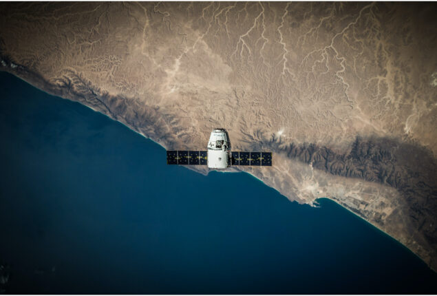
SWOT was scheduled to go into orbit on Thursday before dawn from the Vandenberg US Space Force Base, roughly 170 miles (275 km) northwest of Los Angeles, using a Falcon 9 rocket owned and operated by billionaire Elon Musk’s commercial launch business SpaceX.
If everything goes according to plan, the SUV-sized satellite will generate study data in a few months.
SWOT, which has been in development for almost 20 years, uses cutting-edge microwave radar technology that, according to scientists, will capture height-surface data of oceans, lakes, reservoirs, and rivers in high-definition detail over 90% of the planet.
According to researchers, the information, which was gathered via radar scans of the earth at least twice every 21 days, would improve ocean circulation models, support weather and climate forecasts, and help manage restricted freshwater supplies in drought-stricken areas.
The Jet Propulsion Laboratory (JPL) of NASA, located close to Los Angeles, was where the satellite was created. SWOT was one of 15 missions that the National Research Council recommended NASA carry out in the upcoming ten years. It was developed by the US space agency in cooperation with its colleagues in France and Canada.
Scientist at JPL Ben Hamlington, who also heads NASA’s team studying sea level change, said, “It’s truly the first mission to survey practically all water on the planet’s surface.”
Exploring how oceans absorb atmospheric heat and carbon dioxide as a natural mechanism that lowers global temperatures and slows climate change is one of the mission’s main goals.
SWOT, which scans the oceans from orbit, is made to precisely monitor minute variations in surface elevations around smaller currents and eddies, which are thought to account for a significant portion of the oceans’ absorption of heat and carbon. According to JPL, SWOT can achieve this with a resolution that is ten times higher than that of current technologies.
According to estimates, oceans have absorbed more than 90% of the extra heat that greenhouse gas emissions from human activity have retained in Earth’s atmosphere.
Nadya Vinogradova Shiffer, SWOT’s programme scientist at NASA in Washington, asked: “What is the turning point at which oceans start releasing, rather than absorbing, huge amounts of heat back into the atmosphere and accelerate global warming, instead of limiting it?” Understanding the mechanism by which that occurs will help climate scientists find the answer.
Studying the effects of increasing water levels on coastlines makes use of SWOT’s capacity to identify more minute surface features.
The extent of saltwater intrusion into estuaries, wetlands, and subsurface aquifers could be predicted with more accuracy from data collected along tidal zones.
Another important area of SWOT’s attention is freshwater bodies of water. It is equipped to monitor almost all rivers broader than 330 feet (100 metres), as well as more than 1 million lakes and reservoirs bigger than 15 acres (62,500 square meters).
Researchers will be able to better trace fluctuations in the planet’s rivers and lakes throughout seasonal shifts and significant weather events by repeatedly taking inventory of the planet’s water resources throughout SWOT’s three-year mission.
Tamlin Pavelsky, NASA’s SWOT freshwater science lead, compared gathering such data to “taking the pulse of the world’s water system, so we’ll be able to detect when it’s slow and when it’s racing.”
The radar used by SWOT operates in the microwave spectrum’s so-called Ka-band frequency, which enables scans to pass through cloud cover and darkness over significant portions of the planet. This makes it possible for researchers to more rapidly and correctly map their data in two dimensions, regardless of the time of day or the weather.
Earlier studies of water bodies, in contrast, depended on data collected at specific locations, such as river or ocean gauges, or from satellites that can only track measurements along a one-dimensional line, necessitating the use of extrapolation to fill in data gaps.
According to Pavelsky, “it’s giving us a map of heights, rather than just giving us a line of elevations, and that’s just a whole game changer.”
Catch all the Sci-Tech News, Breaking News Event and Latest News Updates on The BOL News
Download The BOL News App to get the Daily News Update & Follow us on Google News.