


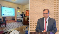
IWMI organises workshop on future water availability for Okara
The International Water Management Institute (IWMI) organised a stakeholders' workshop. The Punjab...

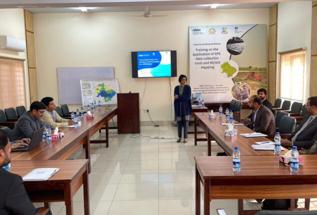
IWMI Pakistan organises capacity-building training workshop
LAHORE: The International Water Management Institute (IWMI) Pakistan organised a two-day capacity-building training workshop for officials of the Punjab Irrigation Department (PID), On Farm Water Management (OFWM) and faculty and students from the University of Okara and University of Agriculture Faisalabad (UAF) sub-campus Depalpur.
Hafsa Aeman, senior research officer of Geo-informatics, IWMI Pakistan, was the lead trainer of the workshop.
“The workshop was aimed at increasing the knowledge and understanding of open-source GPS data collection tools and provide in-depth insight of various applications and benefits of these technologies for enhanced decision-making in the government departments, particularly the Punjab Irrigation Department, the On Farm Water Management and academia,” she said.
Prof Dr Sajid Rashid Ahmed, vice chancellor of the University of Okara orated the welcome note and stressed upon adopting GIS technology in the agriculture sector for innovation.
He also highlighted the need to foster collaboration among the academia and training institutions for knowledge sharing.
Prof Dr Rashid offered full support to IWMI for capacity-building initiatives and research efforts.
Dr Ansir Ilyas, researcher of the Water Resources Management, IWMI Pakistan, said: “Our training programme provided hands-on demonstration of Differential Global Navigation Satellite System (DGNSS) and its application in survey techniques.
The participants gained a deeper understanding of how DGNSS can revolutionise the surveying projects through practical demonstrations and on-ground scenarios. It was specifically designed to enhance the capacity of the government officials and other stakeholders by equipping them with the necessary tools and knowledge needed to stay ahead in the constantly evolving world of surveying.”
The IWMI team demonstrated the actual setup of the Differential Global Positioning System (DGPS) to help the participants understand the use of DGPS for increased accuracy and for identifying the mean sea level.
The participants were tasked to find the accurate location using DGPS and its potential application.
Dr Habib Ullah Habib, director of OFWM Research Farm (Renala Khurd), in his closing remarks said: “The application of GPS and GIS in agriculture is important to measure crop growth and take timely decisions for improved crop productivity. The workshop was useful for OFWM officials and we hope that IWMI will organise such training to further capacitate our staff on the use of remote sensing (RS) and GIS mapping.”
The workshop was organised as part of the Water Resource Accountability in Pakistan (WRAP) Programme Component 1: Climate Resilient Solutions for Improving Water Governance (CRS-IWaG), implemented by IWMI Pakistan with the funding from the UK’s Foreign, Commonwealth and Development Office (FCDO).
Okara is the pilot district of the programme, where different interventions related to water governance, such as groundwater monitoring, water accounting, water allocation system and irrigation demand management, would be introduced.
Catch all the Business News, Breaking News Event and Latest News Updates on The BOL News
Download The BOL News App to get the Daily News Update & Follow us on Google News.