The valley’s oldest community, Askole (3048 meters above sea level), was also the most recent permanent settlement prior to the glacier’s entrance. It was founded, so the story goes, in the sixteenth century by three brothers from Yarkand: Sangar, Goud, and Chow. The names of family groups that remain in the last village Askole Pakistan today bear witness to the fact that the town’s residents are descended from these three.
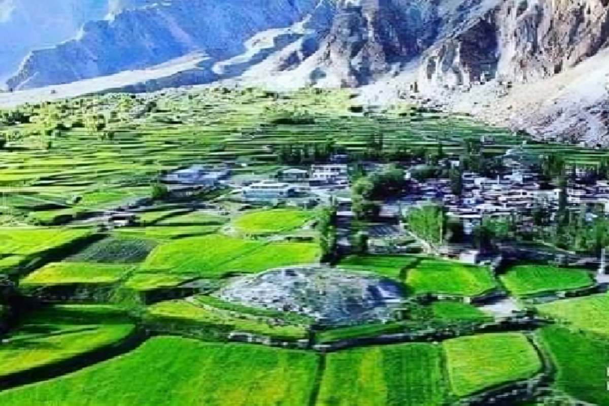
The last village Askole Pakistan is made up of a small cluster of homes that are connected by a single path that passes by the imam-bargah, two mosques, and a few neighborhood stores. Within the context of the valley economy, which is defined by a subsistence agriculture, this little enterprise stands out and is primarily driven by the arrival of mountaineering expeditions and the start of the tourist season in the summer.
While strolling through the hamlet, one is struck by how the structures adjust to the topography of the land: the outside walls frequently take on a circular shape at the corners, enclosing the structures that are connected to the homes, like the small orchards, restrooms, and stables.
The intriguing villages of Monjong and Teste were located on the other side of the valley; these have not yet seen a large influx of visitors. Situated across from Askole, the village of Monjong (pr. Mongron) grows on an alluvial plain. The fields are bigger and the ground is not very terraced. Dispersed dwellings, constructed on enclosed areas designated for the growth of poplars, are located on the periphery of the hamlet. The majority of the homes are destroyed and abandoned. The toponym and the findings of Italian geographer Giotto Dainelli, who visited the location in 1913, both suggest that the village’s initial residents were members of the Mon group, a marginalized and excommunicated class of musicians.
The settlement of Teste rises on the valley’s most advanced post. Some of the buildings were built on the plain, while others were erected on the mountainside, allowing the town to develop on multiple levels: the roofs of the lower houses serve as an access platform for reaching the higher ones, establishing a vertical structure. Despite the fact that Teste was previously more inhabited than the last village Askole Pakistan, it has experienced significant depopulation in recent years.
Aside from housing, religious buildings provide as another point of reference for tiny communities. These structures include the mosque (masjid in Arabic and other Islamic languages) and the Imam-bargah. They differ from residential structures in that they are constructed of sturdy stone walls fitted into a timber framework. They comprise of a prayer room with intricately carved pillars and loggias. In terms of decoration, religious structures tend to have more somber designs, and latticework panels are commonly used.
The mosque of Askole, like the one in Chongo, is a religious reference point for the entire valley. Its oriental façade is made up of a wooden porch that runs the length of the building and houses the entry door.
The imam-bargah, located next to the mosque, is a congregational center where Shia Muslims perform traditional ceremonies. Shia men congregate here to read holy books and discuss their everyday routines.
The wooden ornamentation reaches its pinnacle of beauty inside private homes, in the kaza, where the only source of lighting is the fire or the faint rays of light that penetrate through the hole in the roof, producing a highly suggestive environment.
Horizontal oasis and vertical desert,” as traveler John Staley described the valleys of Karakorum or Qara Qurum, a Turkish word meaning “black mountains,” referring to an imposing mountain range in Central Asia.
The Chinese were the pioneers in the region’s exploration, with Buddhist monk Fa Hsien crossing the Mintika Pass around 390 BCE. During the following century, explorers and dignitaries from other countries (such as Marco Polo or Ibn Battuta) explored the region for diplomatic and exploratory purposes, or in pursuit of adventure. The most significant European exploration dates back to the nineteenth century, while geographical knowledge of the area is primarily owing to missions conducted in the 1920s and 1930s. The explorers encountered breathtaking views and natural landscapes characterized by great contrasts: steep, dry, and rocky valleys, crossed by impetuous streams, and potted across the mountainside by oases of poplars and willows, as well as terracings cultivating cereals and surrounding the village.
The Braldo River valley is characterized by a stark terrain and dramatic reliefs. The hard terrain is separated by fertile alluvial plains made fruitful through artificial irrigation and slope terracing, enabling for the establishment of small villages and the development of vegetation with high poplars, willows, and apricot trees.
Previously, the Braldo Valley was spanned by a track connecting Skardu, Yarkand, and Ladakh, primarily utilized by traders traveling to Kashmir.
The valley is home to the Balti people, an ethnic and linguistic minority who live on the boundary of Indo-European and Tibetan civilizations. They have incorporated features from both civilizations over time.
The Balti populations were originally Buddhist until converting to Shia Islam in the 14th century. The Muslim faith has erased Buddhist civilization, leaving only remnants of material culture and an old Tibetan language.
As you approach the Upper Braldo Valley, the steep topography gives way to larger ground strips. Plain zones and villages include Askole, Surongo, Teste, and Monjong (pronounced Mongron). The residential buildings are near together and separated by tiny and convoluted walkways. The canal marks the main track and diverts water for home use. The towns have a circular shape and are typically bordered by poplar trees.
In general there are no scattered houses. The only isolated structures are mills and barns. Mills (rantak) are spherical buildings with flat roofs and walls built of river cobblestones. The internal stone wheel (bordo) is powered by water falling into a hollowed out tree trunk. The corn container (toroko) is an upturned pyramid composed of intertwined willow branches.
The barns are identical in terms of materials and circular design. The first floor, often built underground, serves as a fold, while the second floor, accessible via an external rung ladder, functions as a hay loft. The walls and roof are of twisted willow hurdles.
Village life is centered on a family subsistence economy. The Balti home has two levels: winter and summer. The winter level, or kaza, is located underground. The structure consists of a rectangular central room with no windows and a wooden pole (obus) in the center. The space is organized around the pole and separated into three areas:
The entrance, with a rung stair, allowing to climb on and descend from the summer level through an opening (karkon). A dormitory area, characterized by small wooden spaces, delimited by pillars (kalep) and partitions (spangut) which show, in ancient houses, richly decorated carvings. The kitchen, characterized by the presence of the fireplace (tap), composed by three stones and bounded by a squared fence. Around the fireplace, the family assembles following the rules of the family structure: there is a zone dedicated to children (pintap), one dedicated to men and guests (šentap), one for the matron and the elders (šintap) and one for the woman managing the kitchen (knut).
A door behind the stairway connects the kaza to the stables, providing direct access to the interior. Walls are typically constructed with river cobblestones, mud, or sun-cooked clay bricks. The family spends the most of the winter in this smokey environment, which fosters robust socialization. The Balti population’s old Tibetan roots may be seen in the fine wooden decorations found in their best homes.
The summer level, or baltì, is the principal chamber of the home, with a big covered courtyard. The baltì level is connected to the roof via a large squared opening (handok) supported by four capitaled pillars in the center of the ceiling.
The balti level houses several rooms, including bedrooms, a kitchen, and a guest room. The door is always left open as a welcome sign. The Balti people welcome guests in the courtyard and serve traditional tea, Kahva. The balti floor is higher than street level and accessible via a rung ladder.
During summer, the handok floor serves as an additional level for daily activities. On the roofs, women spin and beat whool, spread and peel maize, children play, and girls stack dead branches. Zala were small houses made of willow branches that served as granaries or summer dorms.
Balti people do not prefer to stay indoors, as seen by the decrease in building spaces during summer. They develop a strong connection with the environment.